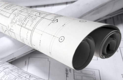
7 Ways Surveyors Can Help You Choose Better Sites, Speed Up Approvals, & Reduce Risk

There are just two ways to increase your property profits… And one of them is much easier than the other.
Your first option is to sell for more. That’s obvious… But not easy. In fact, depending on market conditions or on how soon you need to wrap up the project – it’s often impossible.
Your only other option – especially in cost-heavy projects like subdivisions or property development – is to reduce unneeded expenses.
Yes, the old saying, “A penny saved is a penny earned” still prevails. Any dollar you manage not to spend on your project is one more dollar left in profit at the end.
Of course, this is not new to you. But don’t tune out just yet – as I’m about to give you some information that can save you many, many thousands of dollars over your career.
Since every penny saved is a penny earned, reading this post is a good idea if you enjoy the freedom having more money in your pocket provides.
You know what’s one great way to save money and reduce risk? Making sure you choose the best sites, and accelerate approvals so holding costs won’t eat up all of your earnings.
Kate showed up to the Property Launchpad with no experience. Now she's set to make $100k in the next 12 months!
Want to do the same? Apply now!
Property Launchpad - your ticket into the highly-profitable world of Joint Ventures!
One under-utilised way to do this is by getting THE RIGHT survey job done. It might seem simple enough, but according to Jason Favier and Howard Cutler, two experienced surveyors of ONF Surveyors, that’s not the case.
In fact, Cutler and Favier recently shared with our Property Networking Group that most investors don’t have a clue about what they need from their surveyors. The result? They end up paying for surveys they don’t need and lose precious time waiting for costly revisits to get the right work done.
So what I have here today, thanks to Cutler and Favier, is a comprehensible rundown of the most common types of surveys.
Once and for all, you will know…
1. What each term in their “surveyor lingo” means
2. What to can expect from your surveyor (and what you must DEMAND)
3. When is a certain survey necessary, and when can you pass
4. And some great tips you won’t find anywhere to make sure your deals get the stamp of approval as fast as humanely possible.
Ready? Let’s dive in, starting with the most common survey service you’ll encounter…
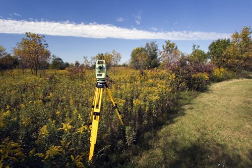
1. Level and Detail Survey

What it is: A level and detail survey provides information on the ground levels, existing structures, contours and services on the site. It also answers questions such as “how will you service the new block?” and “where is the water and sewer, and which way does it flow?”
What you get: A level and detail survey shows the location and detail of all visible services and location and detail of significant vegetation. It also shows the location of external walls, eaves and existing buildings on the site, as well as the location of adjoining structures.
The level and detail survey includes all the plans searches and charges. Your surveyor will go to the state and local government to get information about the site. And, will provide a level and detail survey in digital format so you can share it with your draftsperson, town planner or engineer.
Why it’s important: The level and detail survey tells you what you have on the ground and identifies things that could have a bearing on the development or subdivision of your site.
For example, if you have trees or other vegetation on site, having a level and detail survey will help you to find out if the vegetation is protected by the local council.
Other considerations: With the level and detail survey, Jason said that surveyors don’t generally insert pegs to mark the property boundaries—unless you ask. That’s because pegs cost extra and may not be necessary at this point in your project. However, the surveyor will locate the boundary and establish site benchmarks so your builder can relate the levels they’ve taken to a mark on-site.
The level and detail survey also will show the location of fences on the property, but Howard said that it’s also important to remember that fences do not necessarily mark the boundaries.
Jason also offered an important tip, saying that property investors should look for properties with drainage that flows toward the street—not away from the street—to help with runoff management.
2. Natural Ground Level (NGL) Contours

What it is: NGL contours look at old infrastructure to determine what is under your development site. NGL contours can be done as an add-on to your level and detail survey.
What you get: Your surveyor will search through local government records and do special searches on-site to find where the location of old infrastructure. You’ll receive two sets of contours: one showing what is on the ground now, and the other showing what was there historically.
Why it’s important: NGL contours could be required if you aim to build a two-story home or raise an existing dwelling so you can build underneath. Council will restrict the height of your development based on what the natural ground levels are—not what is on the site today.
Jason cited an example of an area that has a lot of fill and sewer manholes buried about 2.5 meters below the ground. He said that NGL contours are especially important if you are thinking about building a multi-story building or raising a dwelling in Brisbane and along the coast.
However, NGL contours are usually not important if you are subdividing land.
Other considerations: Jason says that in some NGL contour surveys, both sets of contours are identical. However, in others, they’re not. Jason recommends giving your surveyor an idea of what you plan to do with the development site can help them to advise you on whether you should include NGL contours with your level and detail survey.
3. Proposal Plan
What it is: The proposal plan is attached to your development application and is what council looks at to determine if they are happy with the block size and configuration of your proposed development.
Jim Valery shares his Property Launchpad experience!
Do you want simple, predictable, big-time property profits? Save your seat now!
Property Launchpad - your ticket into the highly-profitable world of Joint Ventures!
What you get: Your surveyor will liaise with your town planner, project manager and engineer and use the boundaries that have been measured on the ground over what your survey plan (the official record of the legal boundaries of the land) shows as the boundaries.
Why it’s important: The proposal plan gives council an idea of how your proposed development or subdivision will look.
Other considerations: Your original survey plan could be from more than a century ago and is not actually what you own, so you should make sure that the subdivided block size is what you end up with in the end.
4. Boundary Identification Survey

What it is: During a boundary identification survey, your surveyor will place pegs in the ground marking the boundaries of your property.
What you get: You will receive a survey plan that becomes a legal document filed with the state government. Your surveyor will mark the boundaries of your property with pegs in the ground.
Why it’s important: This legal document can be used to resolve disputes with adjoining owners or council regarding where the boundaries are located. It also can identify any encroachments.
Other considerations: Boundaries are not usually marked during a level and detail survey, so you need to specifically request boundary identification if you need legal documentation.
If you know you’re going to need it, it can be added on to the level and detail survey. Also, boundary identification does not change your title.
If an encroachment is found during your boundary identification survey, the surveyor is legally required to inform all affected adjoining owners.
5. Subdivision Survey
What it is: During the subdivision survey, your surveyor will place pegs in the ground marking the boundaries of your subdivided lots.
What you get: You will receive a survey plan for your subdivided lots that becomes a legal document filed with the state government. Your surveyor will mark the boundaries of your property with pegs in the ground.
Jason says that the subdivision survey is like a boundary identification survey, but a lot more valuable.
Why it’s important: A subdivision survey will change the title of your property, which is the end-game for most people. It will allow you to sell and develop your subdivided lots.
6. Building Format Plan
What it is: A building format plan is required when the boundaries of the building (walls, floors or ceilings) become the property boundary, such as in a duplex or apartment. The infrastructure becomes the boundary, but you are not subdividing the land.
What you get: Although the land is still owned under a common property, a building format plan defines which unit owner has exclusive use of certain parts of the common property.
Why it’s important: A building format plan clarifies what each unit owner is responsible for and can be used to resolve disputes.
Other considerations: With a building format plan, you need to get a community-managed statement (CMS) that details how the building format and strata is managed and outlines the rules and regulations between lot owners. Surveyors do not provide CMSs, but they work with managers who can provide them.
You also need to obtain a services location diagram, which shows each unitholder where the services are located on the property. “It’s usually just a sketch from the builder that is tidied up and included with the CMS,” says Jason.
7. As-Constructed Survey

What it is: The as-constructed survey shows where the infrastructure on the site has been built. The survey is performed after construction is completed.
What you get: You will receive separate surveys showing the locations of each infrastructure (roadworks, sewer, water, etc.) that are contained within one digital file.
Why it’s important: Because they are taking ownership of the infrastructure and will be providing future maintenance, councils want to know where the infrastructure is located, if it was built as designed and whether it was installed at the proper depth, offset from the boundaries, etc.
Other considerations: Most councils want the as-constructed survey in an Asset Design and As Constructed (ADAC) digital format so that it can be loaded into their mapping software programs.
However, there are certain scenarios when ADAC format is not required. You should be sure to check with your engineer and surveyor to find out if it must be delivered in ADAC format.
Because each type of survey provides different information and performs different functions, it is critical that property investors know what they need for each type of development.
By having an experienced surveyor on your team, you can minimize risk, save time and avoid costly mistakes by getting the right type of survey for your project.
Make sure you give Howard Cutler and Jason Favier a call from ONF Surveyors and tell them Matt sent you! (07) 5422 0200 or [email protected]
Peter Baumann shares his Property Launchpad experience!
Do you want simple, predictable, big-time property profits? Save your seat now!
Property Launchpad - your ticket into the highly-profitable world of Joint Ventures!
0 thoughts on "7 Ways Surveyors Can Help You Choose Better Sites, Speed Up Approvals, & Reduce Risk"